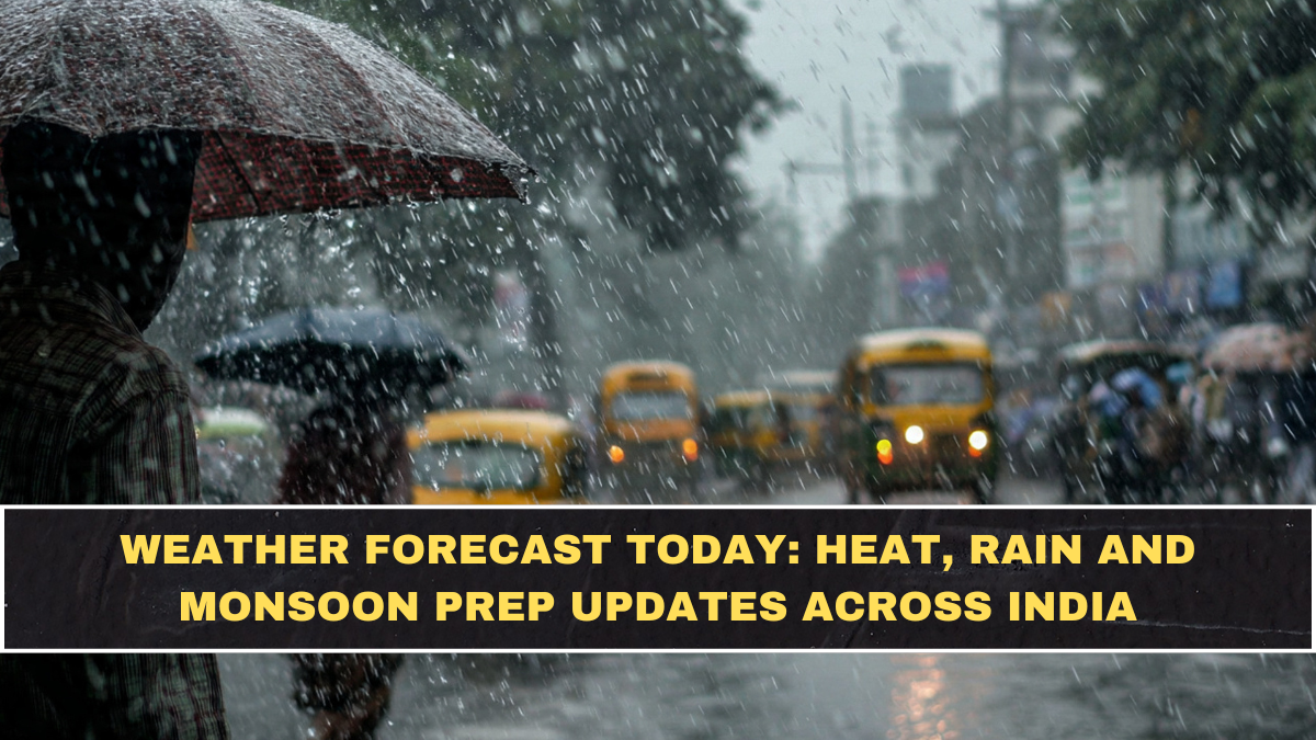
India’s weather forecast today is being shaped by rain, thunderstorms, gusty winds and localised hailstorm activity across several regions. The India Meteorological Department’s May 4 update said isolated to scattered thunderstorms, lightning, gusty winds of 40–60 kmph and hailstorm are likely over northwest, central and east India during May 4–5, 2026. This means the main risk today is not only heat, but sudden severe weather.
The forecast matters because early May usually brings strong heat across many parts of India, but this year several regions are seeing active weather systems. Rain may give short-term relief from high temperatures, but thunderstorms and strong winds can still create travel disruption, crop damage, power outages and safety risks. Readers should treat today’s weather as unstable rather than simply “hot” or “rainy.”

Which Regions Have Rain And Thunderstorm Risk Today?
Northwest India, central India and parts of east India are under the main thunderstorm, lightning and hailstorm watch for May 4–5. In Rajasthan, a fresh western disturbance is expected to keep thunderstorms, dust storms, rain and isolated hailstorms active through the week. Jaipur, Dausa, Jhunjhunu, Sikar and Alwar were forecast to see intense storms with around 60 kmph winds, while Ajmer, Bikaner and Bharatpur divisions could see gusts up to 70 kmph.
Punjab, Haryana and Chandigarh also remain under active weather conditions. Times of India reported that IMD forecast continued rain, thunderstorms and gusty winds across Punjab, Haryana and Chandigarh till May 6, with chances of thundersqualls and isolated hailstorms on May 4 and 5. Maximum temperatures there are expected to fall by 3–5°C over the next few days.
What Are The Key Weather Updates In Simple Form?
| Region / State | Main Weather Risk | Data-Based Update |
|---|---|---|
| Northwest, Central, East India | Thunderstorms, lightning, hailstorm | IMD warning for May 4–5 with 40–60 kmph gusty winds |
| Rajasthan | Dust storms, rain, hailstorm | Gusts up to 60–70 kmph in several divisions |
| Punjab, Haryana, Chandigarh | Rain, thundersqualls, hailstorm | Inclement weather likely till May 6 |
| Kerala | Heavy rain at isolated places | Yellow alert remains in force till May 9 |
| Tamil Nadu, Puducherry, Karaikal | Heat and humidity risk | Hot, humid pockets remain possible in May pattern |
| Many parts of India | Below-normal daytime temperatures possible | IMD May outlook points to above-normal rainfall nationally |
This table shows why weather forecast today India is not a single-condition story. Some regions are getting rain relief, some are facing severe thunderstorm risk, and some southern areas may still feel hot and humid. The better reading is regional, not national-general.
What Is Happening In Kerala And South India?
Kerala is under a heavy rainfall watch at isolated places till May 9. Times of India reported that Wayanad, Palakkad and Idukki were expected to receive heavy rainfall on Monday, while Ernakulam, Idukki and Wayanad were forecast for Tuesday. IMD also warned of thunderstorms with lightning and gusty winds at one or two places over Kerala till Thursday.
This is important for travellers and residents because Kerala’s weather risk is different from dry heatwave conditions. Heavy rain in hilly districts such as Idukki and Wayanad can create localised landslide, road-safety and visibility concerns. People should avoid treating yellow alerts casually, especially when rainfall combines with lightning and gusty winds.
Is Heatwave Still A Concern In May 2026?
Heatwave risk has not disappeared, but rain activity is reducing severe heat in many places for now. Down To Earth reported, based on IMD’s May outlook, that maximum temperatures are expected to be normal to below normal across many parts of India because of above-normal rainfall. However, parts of southern, northeastern and northwestern India may still see higher temperatures, warmer nights and more heatwave days.
Rajasthan shows this mixed pattern clearly. Rain and cloudy weather are likely to keep temperatures below 44°C in most parts of the state, delaying severe heatwave conditions for now. But western Rajasthan remained hot, with Phalodi recording 44.8°C and Chittorgarh touching 43.4°C on Sunday.
Why Should Farmers And Travellers Be Alert?
Farmers should be alert because sudden rain, hail and strong winds can damage crops and stored produce. Punjab’s case is a warning. Times of India reported that untimely rain and strong winds raised concern over nearly 50 lakh metric tonnes of wheat lying in mandis awaiting lifting. Mohali saw wind speeds up to 76 kmph, and Hoshiarpur reported uprooted trees and electricity poles.
Travellers should also take the forecast seriously. Thunderstorms can delay flights, reduce highway visibility, disrupt trains and damage temporary structures. The biggest mistake is assuming that rain automatically means relief. In May, rain often comes with lightning, dust storms or sharp wind bursts, which can be more dangerous than steady showers.
What Does The May Weather Outlook Say About Monsoon Prep?
IMD’s May outlook points to above-normal rainfall over India as a whole, with rainfall likely around 110% of the long-period average for the month. Down To Earth also reported that maximum temperatures may remain normal to below normal across many parts of the country due to rainfall. This gives cities and states a chance to prepare drainage, power systems and flood-prone zones before the full monsoon pressure builds.
For cities like Mumbai, monsoon preparation should not wait until the first major flooding day. Drain cleaning, pump readiness, traffic diversion planning and warning systems matter before heavy rain arrives. The national weather pattern already shows unstable early-May conditions, so city administrations need to treat monsoon prep as urgent, not seasonal paperwork.
What Is The Conclusion?
Weather forecast today India shows a mixed and unstable pattern. IMD has warned of thunderstorms, lightning, gusty winds of 40–60 kmph and hailstorm over northwest, central and east India during May 4–5. Rajasthan, Punjab, Haryana, Chandigarh and Kerala are seeing active weather alerts, while parts of the country may get short-term heat relief from rainfall.
The clear takeaway is this: today’s weather is not just about heat. Rain may cool temperatures, but strong winds, lightning, hailstorm and sudden squalls can create real risk. Readers should check local IMD alerts before travel, protect outdoor goods, avoid standing under trees during thunderstorms and take warnings seriously.
FAQs
Which Parts Of India Have Thunderstorm Warnings Today?
Northwest, central and east India are under IMD’s thunderstorm, lightning, gusty wind and hailstorm warning for May 4–5, 2026. IMD said gusty winds may reach 40–60 kmph in affected areas during this period.
Is Kerala Under Heavy Rain Alert?
Yes, Kerala has a yellow alert for heavy rainfall at isolated places till May 9. Districts including Wayanad, Palakkad, Idukki, Ernakulam, Thrissur, Alappuzha and Kottayam are mentioned across different days in the forecast.
Will Rain Reduce Heatwave Conditions?
Rain may reduce heat in several areas, but heatwave risk has not fully disappeared. IMD’s May outlook suggests normal to below-normal maximum temperatures across many parts of India, while some southern, northeastern and northwestern regions may still see higher temperatures and warmer nights.